
File:Hadrians Wall map.png
Size of this preview: 385 × 479 pixels.
| |
This is a file from the Wikimedia Commons. Information from its description page there is shown below.
Commons is a freely licensed media file repository. You can help. |
 |
File:Hadrians Wall map.svg is a vector version of this file. It should be used in place of this raster image when superior. File:Hadrians Wall map.png
For more information about vector graphics, read about Commons transition to SVG.
|
 |
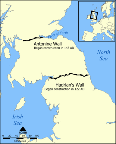
This map shows the location of Hadrian's Wall and the Antonine Wall in Scotland and Northern England.
Created by NormanEinstein, September 20, 2005.
|

derivative works
Derivative works of this file:
File usage
The following pages on Schools Wikipedia link to this image (list may be incomplete):
Background information
SOS Childrens Villages aims to make Wikipedia suitable for young learners. Thanks to SOS Children, 62,000 children are enjoying a happy childhood, with a healthy, prosperous future ahead of them. Sponsoring a child is a great way to help children who need your support.