
File:Rwanda Topography.png
Size of this preview: 611 × 480 pixels.
| |
This is a file from the Wikimedia Commons. Information from its description page there is shown below.
Commons is a freely licensed media file repository. You can help. |
Summary
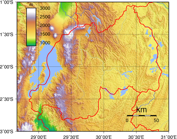
| Description | Topographic map of Rwanda. Created with GMT from publicly released SRTM data. |
| Date | 17 June 2007 |
| Source | Own work |
| Author | Sadalmelik |
Licensing
 |
This work has been released into the public domain by its author, I, Sadalmelik. This applies worldwide. In some countries this may not be legally possible; if so: I, Sadalmelik grants anyone the right to use this work for any purpose, without any conditions, unless such conditions are required by law.
|
File usage
The following pages on Schools Wikipedia link to this image (list may be incomplete):
The best way to learn
SOS Children chose the best bits of Wikipedia to help you learn. SOS Childrens Villages cares for children who have lost their parents. Our Children's Villages give these children a new home and a new family, while a high-quality education and the best of medical care ensures they will grow up with all they need to succeed in adult life. Help another child by taking out a sponsorship